|
||||
|
||||
|
|||||||||||||||||||
|
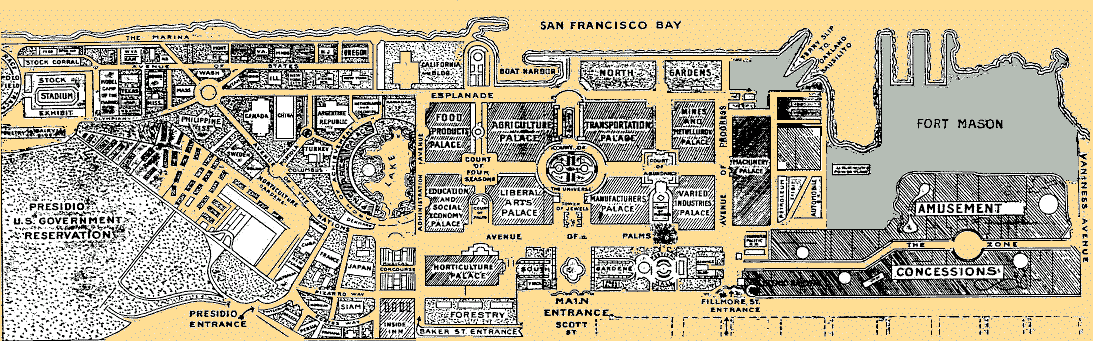
Panama-Pacific International Exposition grounds in what is now the Marina District. This was swampland until hydraulic pumping filled in the area, and piles driven to support the 1915 Exposition buildings. Only the Palace of Fine Arts remains as a reminder of the 1915 Exposition.
Liquefaction
of the filled- The entrance gates at the bottom of the map are along Lombard Street, and the Esplanade became Marina Boulevard. Administration Avenue, in front of the Palace of Fire Arts, is Baker Street. The Avenue of Progress became an extension of Fillmore Street. “The Zone,” at the right of the map, ran approximately along Francisco Street from Van Ness Avenue on the east, then jogged to the south along the line of Chestnut Street. The jog occurs at what is now Chestnut and Laguna streets. Western entrance to “The Zone” was at about Fillmore and Chestnut streets, close to the main entrance gate at Fillmore and Lombard. The southern portion of the Palace of Machinery site is currently the Marina Middle School. The famed Tower of Jewels was located at about the intersection of Scott Street and Capra Way. It is interesting to compare this map with the USGS map of buildings in the area damaged by the 1989 earthquake. |